Wubi News

Warnings of snow, wind and rain across the UK for New Year

2024-12-29 23:01:27
Warnings for possible snow cover areas in Scotland, northern England and Northern Ireland over the New Year [file pic]

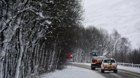
Weather warnings have been issued for rain, snow and winds of up to 70mph for parts of the UK on New Year's Eve and New Year's Day, the Met Office has said.

Yellow warnings are in place for wind, rain and snow for Northern Ireland, northern England and parts of Scotland from Tuesday.

By New Year's Day the yellow weather warnings for rain, wind and snow extend across most of the UK.

The forecaster said there was likely to be travel disruption.

The warnings begin to come into force from 00:00 GMT on Monday and will last in some areas until 06:00 GMT on 2 January.

Following a period of heavy rain and some hill snow in Scotland on Monday, two areas of low pressure will bring unsettled conditions on both New Year's Eve and New Year's Day and eventually lead to a cold plunge of air from the north and a drop in temperature.

On New Year's Eve, there could be as much as 100-140mm (3.9- 5.5 inches) of rainfall in some parts of western Scotland which could lead to localised flooding. There could be some further snow in northern parts of the country too.

There will also be spells of rain across England, Northern Ireland and Wales. The rain looks particularly heavy in Wales.

While it will be windy everywhere it could be very blustery in the south of England as the new year is welcomed in.

The weather warnings in place across the UK include:

More widespread disruption is expected on New Year's Day as another area of low pressure moves across the UK.

The strongest winds will be over England and Wales with gusts near 70mph over coasts and hills in the south and west.

Rain is forecast to be heavier in Wales on Wednesday, which could bring some flooding.

Possible snowfall may lead to disruption in Northern Ireland, Scotland and northern England.

Forecasters said 10cm of snow was expected in some areas with heavier falls over hills with blizzards and drifting.

Disruption could continue on Wednesday night. By the morning of Thursday 2 January, as the area of low pressure clears into Europe, arctic air may sweep towards the UK.

From Thursday into next weekend it will be much colder everywhere with widespread frosts. Most places will be dry and sunny during the day but wintry showers will affect northern areas and lead to icy conditions.